Data Management
Data management that works
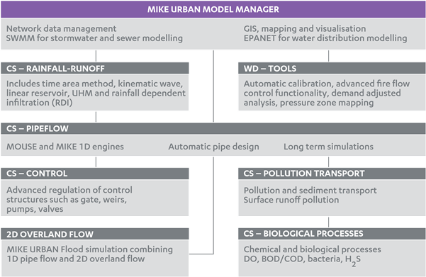
MIKE URBAN utilises the feature-rich GIS environment from ESRI’s ArcGIS at no extra cost. MIKE URBAN also comes with customisable import and export interfaces with many templates for the most relevant industry standards. It contains sophisticated management of time series, such as from rain events.
MIKE URBAN works in all dimensions. Make use of your digital elevation models for example for delineation of catchment, creation of cross-sections, interpolation and assignment of ground level values.
Whether you are working on a master plan, strategies for operational maintenance, water quality optimisation, real time control strategies or something else entirely - MIKE URBAN supports you in every step of your project and delivers results in an understandable manner.
BENEFITS
Among the tools and features that help improve efficiency are:
- Scenario manager
- Data validation, assignment and interpolation tool
- Catchment delineation tool
- Network simplification tool
- Geocoded load and demand allocation
- Flexible and easy to understand presentation of results
- Freeware result viewer: MIKE View
- and many more…

Read more